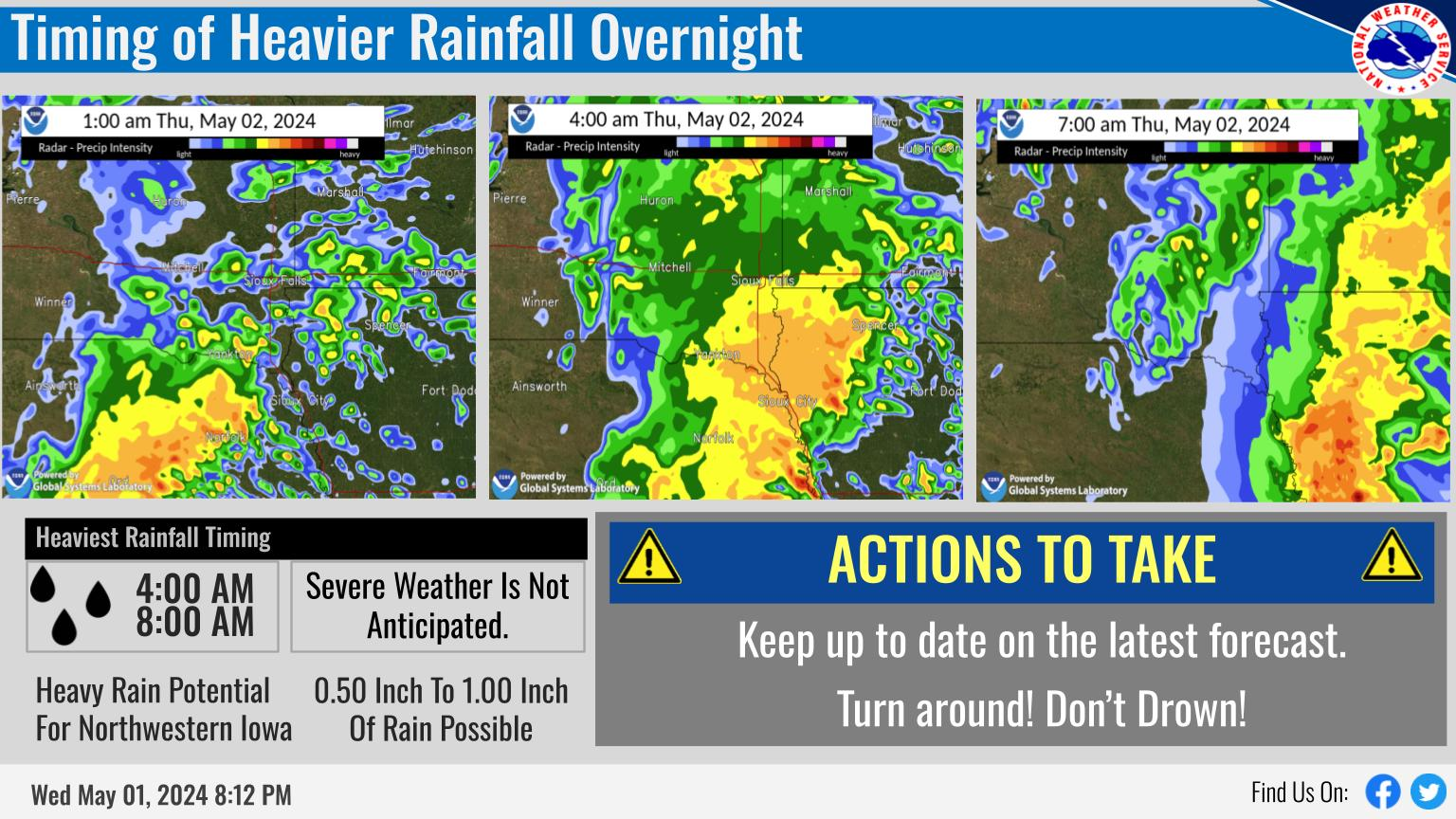
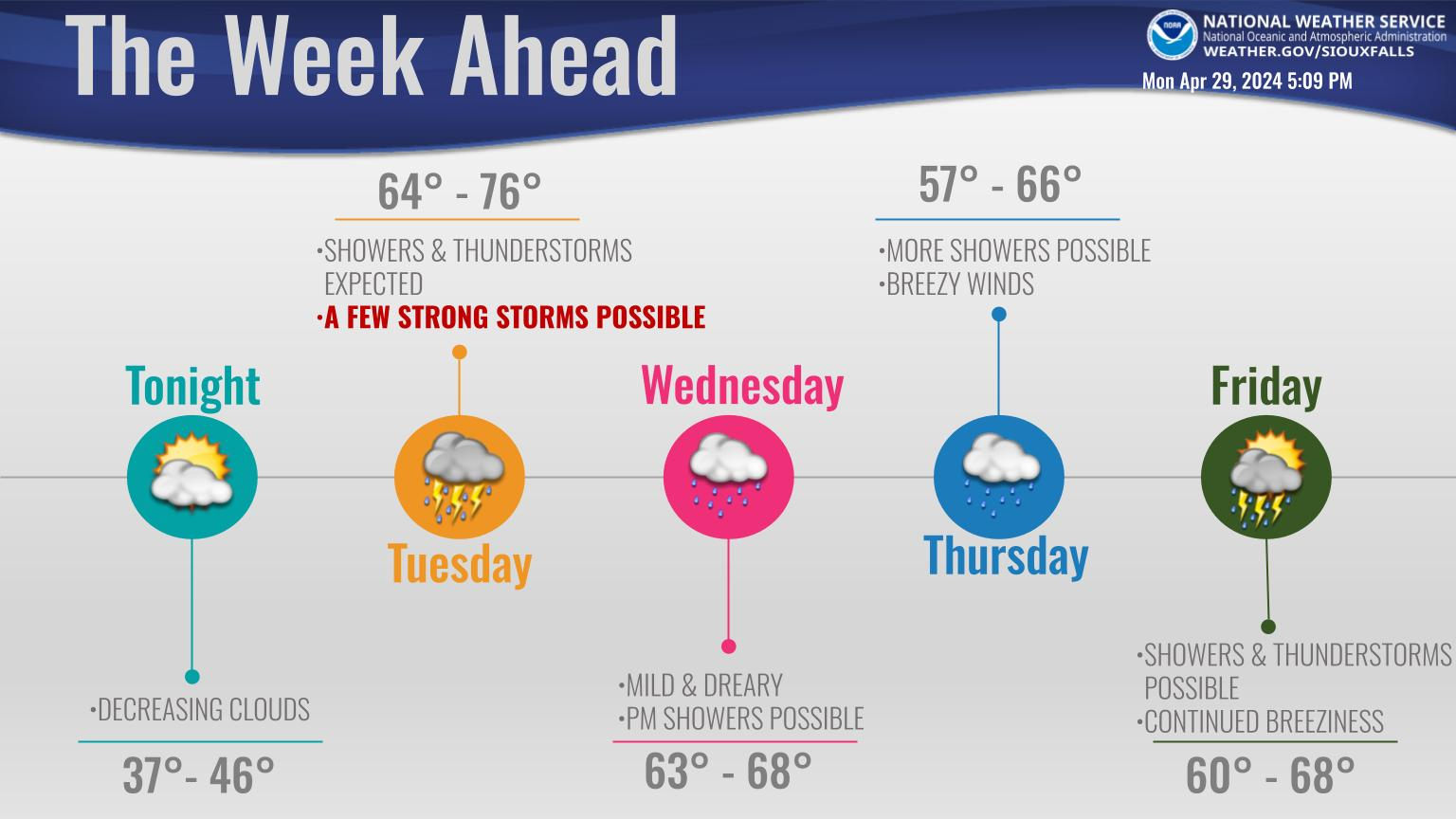
A front will move through from west to east during the day, bringing chances for rain and thunderstorms. A few of the thunderstorms could be strong with abundant lightning and hail. Temperatures in the mid 80s ahead of the front will give way to 70s behind the front. Tuesday brings a cool & dry summer day, followed by a steady warm-up for the rest of the week.
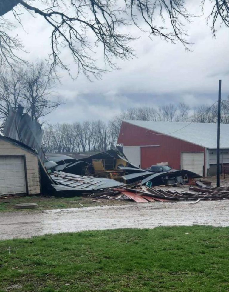
The threat for severe weather later this afternoon and evening has been upgraded to enhanced risk across parts of northwest Iowa, including Sioux City, Le Mars and Storm Lake area. Large hail, damaging wind gusts and isolated tornadoes are the main risks. If outdoors, keep an eye on the skies, have a way to receive weather alerts, and know where your nearest shelter is located.
Iowa DOT Road Conditions: CLICK HERE
For Iowa DOT Plow Map: CLICK HERE
Minnesota DOT Road Conditions: CLICK HERE
South Dakota DOT Road Conditions: CLICK HERE
Nebraska DOT Road Conditions: CLICK HERE
North Dakota DOT Road Conditions: CLICK HERE
Missouri DOT Road Conditions: CLICK HERE
Illinois DOT Road Conditions: CLICK HERE