
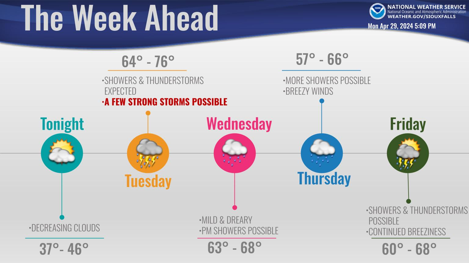
Moderate to heavy rain will continue to surge north into the region this morning. Rain will continue throughout the day, before gradually diminishing in intensity through the evening hours. Rainfall totals from 1 to 2 inches are expected, locally higher amounts possible. Don’t be surprised if you hear thunder! Scattered thunderstorms are also expected. With snow melt on-going and heavy rainfall expected, flooding risks are increasing. If traveling, remember to turn around if you encounter water-covered roadways.
…The National Weather Service in Sioux Falls has issued a flood
warning for the following rivers in South Dakota…Iowa…
James River Near Scotland
Vermillion River Near Wakonda
Big Sioux River At Sioux Falls North Cliff
Big Sioux River above Hawarden
Big Sioux River At Akron
Split Rock Creek Near Corson
Rock River At Rock Rapids
Rock River At Rock Valley
Floyd River At Sheldon
Floyd River At Alton
West Branch Floyd River Near Struble
Floyd River At Le Mars
Floyd River At Merrill
Floyd River Near James
Ocheyedan River Near Spencer
Little Sioux River near Milford
Little Sioux River at Spencer
Little Sioux River At Linn Grove
Little Sioux River At Cherokee
Little Sioux River Near Correctionville
West Fork Ditch Near Hornick
.The following river forecasts include forecast precipitation through
tonight. Any additional future rains could affect the crest
forecasts.
PRECAUTIONARY/PREPAREDNESS ACTIONS…
Safety message…Do not drive cars through flooded areas. the water
depth and road condition may be unsafe.
Additional information is available at
http://water.weather.gov/ahps2/index.php?wfo=fsd
Iowa DOT Road Conditions: CLICK HERE
For Iowa DOT Plow Map: CLICK HERE
Minnesota DOT Road Conditions: CLICK HERE
South Dakota DOT Road Conditions: CLICK HERE
Nebraska DOT Road Conditions: CLICK HERE
North Dakota DOT Road Conditions: CLICK HERE
Missouri DOT Road Conditions: CLICK HERE
Illinois DOT Road Conditions: CLICK HERE