

Northwest Iowa — A Slight Risk of severe storms has been issued by the Storm Prediction Center for Wednesday afternoon and evening.
In addition, with very strong winds expected on Wednesday, various Wind Headlines have been issued across the region.
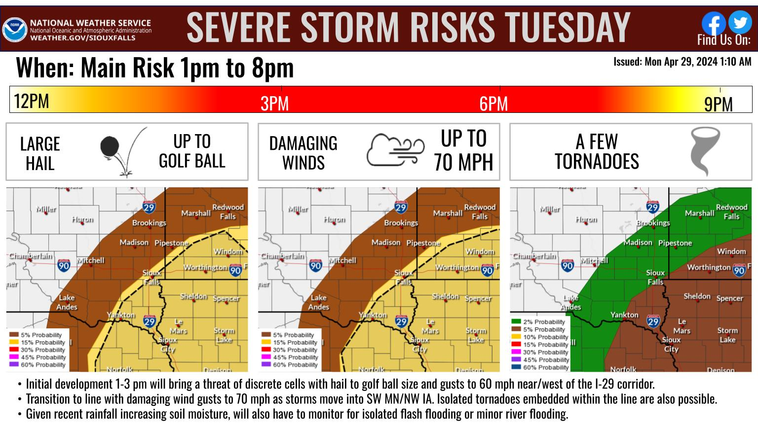
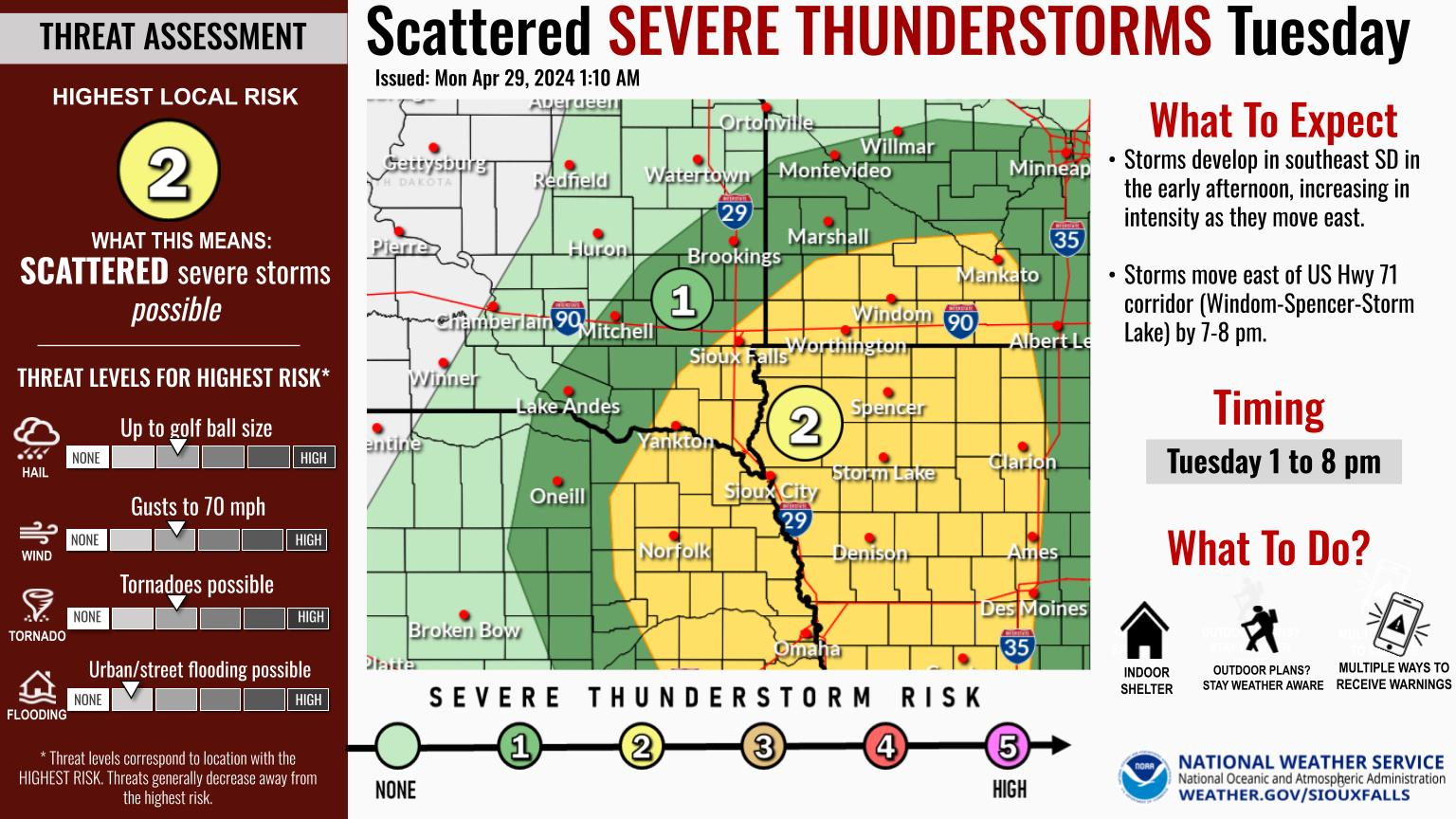
A strong storm system will push into the region on Wednesday. This system will produce strong wind gusts, and the possibility of scattered severe thunderstorms around northwestern IA. In addition, light rain will change to light snow in the evening as colder air sweeps in behind the system.
Lyon-Osceola-Dickinson-Sioux-O`Brien-Clay-Plymouth-Cherokee-
Buena Vista-Woodbury-Ida-Dixon-Dakota-Gregory-Charles Mix-Douglas-
Hutchinson-Turner-Lincoln-Bon Homme-Yankton-Union-
1211 PM CST Tue Dec 14 2021

...HIGH WIND WARNING REMAINS IN EFFECT FROM NOON WEDNESDAY TO
MIDNIGHT CST WEDNESDAY NIGHT...

* WHAT...Southwest winds 30 to 40 mph with gusts up to 60 mph
  expected.

* WHERE...Portions of south central and southeast South Dakota,
  northeast Nebraska and northwest and west central Iowa. This
  includes the Tribal Lands of the Yankton Sioux Tribal Nation.

* WHEN...From noon Wednesday to midnight CST Wednesday night.

* IMPACTS...Damaging winds will blow down trees and power lines.
  Widespread power outages are expected. Travel will be
  difficult, especially for high profile vehicles.

PRECAUTIONARY/PREPAREDNESS ACTIONS...

People should avoid being outside in forested areas and around
trees and branches. If possible, remain in the lower levels of
your home during the windstorm, and avoid windows. Use caution if
you must drive.