Northwest Iowa — Scattered to numerous storms are expected to develop this afternoon and evening, with another round of storms possible late Thursday afternoon and evening.
A tornado watch has been issued for parts of Iowa, Minnesota, Nebraska and South Dakota until 9 PM CDT pic.twitter.com/tqsgZcrc3k
— NWS Sioux Falls (@NWSSiouxFalls) May 11, 2022
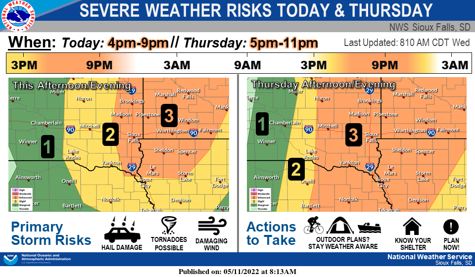
For today, the primary threats are very large hail and tornadoes, especially in areas along and east of I-29. If storms develop later Thursday, the primary threats will be large hail and damaging winds. If you have outdoor plans, make sure to stay weather aware, and have a plan to seek shelter if storms develop.
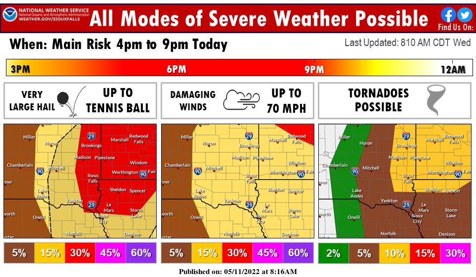
All modes of severe weather are possible later today, with very large hail up to tennis ball size and tornadoes the primary risks. The greatest threat for tornadoes looks to be near and north of I-90 in far eastern South Dakota and southwest Minnesota, but this may change depending on how things evolve throughout the day. Now is the time to make sure you’re prepared for severe weather later today!
Isolated thunderstorms are possible through mid morning. Hail up
to quarter size hail may occur with these storms.

Very warm and humid conditions are expected this afternoon with
heat indices in the mid to upper 90s.

Late this afternoon scattered thunderstorms are expected to
develop. Storms would be capable of producing hail up to 2.5
inches in diameter and wind gusts to 70 mph. An isolated tornado
is possible near the Minnesota and Iowa border. The storms are
expected to move north of the area by sunset.

Very warm and humid conditions on Thursday afternoon will produce
heat indices from 90 to 95 degrees.

Thunderstorms are expected to develop in the late afternoon on
Thursday west of I-29. These storms will develop into a squall
line as they approach I-29 in the early evening. Hail up to 1.5
inches in diameter and wind gusts to 75 mph will be possible.