
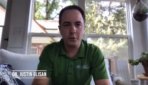
IARN — Iowa’s state climatologist says farmers could continue to see ideal weather conditions as the 2021 harvest season gets into full swing.
Speaking with the Iowa Agribusiness Radio Network Thursday morning, Justin Glisan explained that current weather models suggest a warm and dry pattern to continue through the end of the month, which bodes well for the state’s farmers as combines hit the fields.
“Basically, daytime highs average towards the late part of September in the mid-70s with overnight lows in the upper 50s and lower 60s,” said Glisan. “We’re seeing daytime temperatures in the next seven days getting up in the 80s and low 90s, so that’s 12-15 degrees above average. Coupled with that, we do see a drier signal with a hint of a seesaw behavior.”
Glisan says that ideally, farmers need a good dry period to get harvest equipment out and about.
“We don’t want to get into very wet conditions,” said Glisan. “There is nothing in the outlooks in the short term that suggest we would get into a wet pattern. A rain shower or thunderstorm here or there would be great in the drier regions just to get subsoil moisture recharged for the next growing season, but ideally, in terms of getting the combines out and getting field work completed, let’s have a dry stretch and then turn on the faucet when we are finished.”
As for ongoing drought conditions in the state, Glisan says the weekly U.S. Drought Monitor continues to show great improvement compared to where things were in the mid-to-later parts of August.
“Towards the end of August and into September with that more active storm track, we actually saw rainfalls across much of the northern half of the state – which has been the driest part of the state – on the order of 5 to 10 inches,” said Glisan. “When we did see those heavier rainfalls over several days, we did get a good amount of that rain into the ground. We also saw some bounce back in the stream flows. Overall, we are still dry across the state. Now, if we look at a change map of where we were a month ago to where we are now, we’ve seen anywhere from a one to two category improvement across the state given those widespread and beneficial rainfalls.”
The latest U.S. Drought Monitor for Iowa can be viewed here.
Story courtesy of the Iowa Agribusiness Radio Network.