
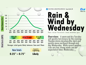
Northwest Iowa — Another warm and dry Tuesday is expected, but changes are on the way!
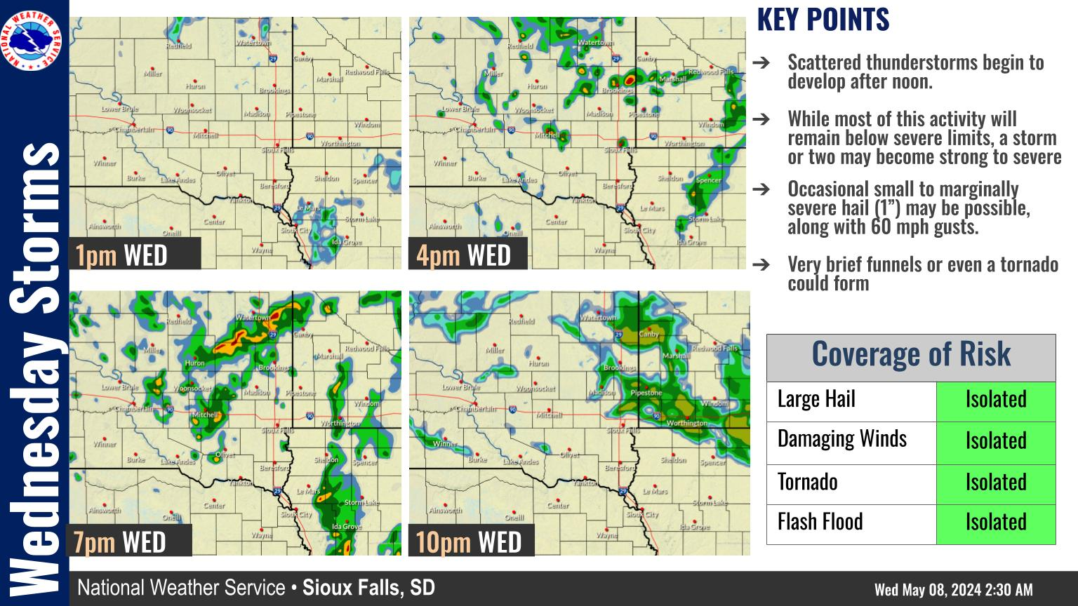
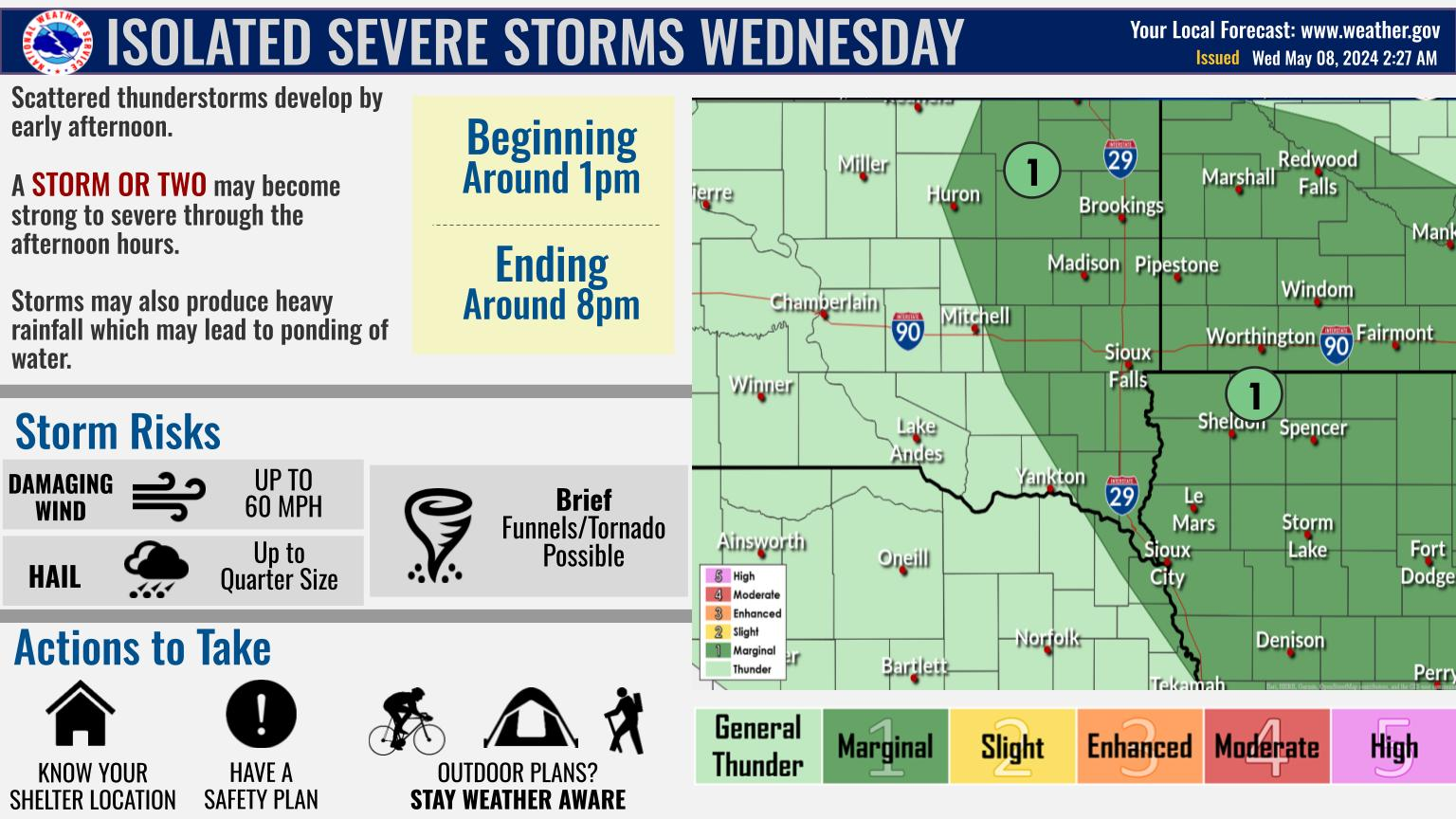
Winds turn breezy this evening, and rain chances increase through the night as showers and thunderstorms move northeast towards the area. While severe weather risks are low, strong wind gusts may be possible after 3am Wednesday and through mid-day as a very large system moves through the Plains. Rain will end by the afternoon, and winds will slowly weaken by the evening hours.
Showers and thunderstorms will become more widespread later tonight. Overnight showers and storms will be capable of producing strong and gusty winds, with a low threat south of I-90 for a stronger thunderstorm to produce winds to around 60 mph. Behind this initial line on Wednesday morning, IF storms can manage to redevelop along the frontal boundary and lift northeast during the morning, an isolated storm could be capable of damaging winds or even a brief tornado. Even if no severe storms develop, showers and weaker thunderstorms will still be capable of producing wind gusts to around 50 mph during the morning.