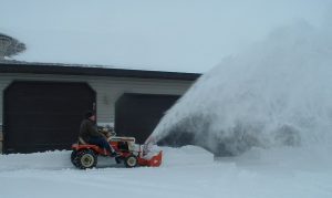
Northwest Iowa — There’s no doubt we’ve been spoiled by the lack of snowfall this snow season. Here in Sheldon, we’ve received less than one-half-inch of snow so far this season, but the National Weather Service says the lack of snow is forecast to come to a screeching halt later this week.
We talked to Matthew Meyers at the National Weather Service in Sioux Falls early Wednesday afternoon and he tells us that exact snowfall amounts are hard to predict at this point.
Meyers says the difficulty in predicting exact snowfall amounts at this point is because the storm system has the potential to move further north, or further south.
The National Weather Service has issued a Winter Storm Watch that will go into effect at 6:00 Friday morning and continue through midnight Friday night for the southern portion of the KIWA listening area.
Meyers says the storm system that is expected to effect this area currently is west of California, but should move east beginning early Thursday.
Once the system moves through this area, we’ll again see sunny skies, with highs through the weekend in the upper 20’s to upper 30’s.


