Northwest Iowa — Dry conditions continue to creep into our part of northwest Iowa.
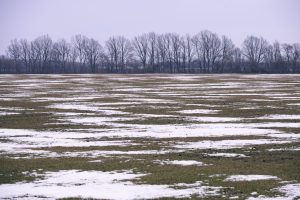
The National Weather Service says most of northwest Iowa went through most of the winter with little to no snow. Sheldon has only reported about 14 inches since the first of September, whereas we normally have over 30 inches by this late in the season.
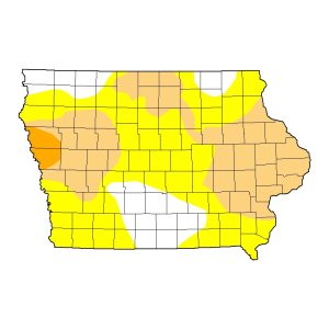
According to the National Drought Monitor, hosted at the University of Nebraska-Lincoln, an area of what they call “abnormally dry” or D0 started creeping into southern O’Brien County about two months ago — on the January 11th report. Since then, it has expanded north and west, and now covers the majority of Sioux and O’Brien counties.
What appears as a wave starts about halfway between the north and south borders of Sioux County on the Big Sioux River, and rises slowly to the north, peaking just south of Sheldon before it starts to fall again south of Sanborn, and exits O’Brien county on the east a little further south than halfway up the county.
An area of what they call “Moderate Drought” or D1 covers southern Plymouth County and about half of Cherokee County. It also seems to be expanding. Meanwhile, most of Woodbury and Monona counties are listed in “Severe Drought” or D2. That appears to be the driest patch in the state at this time.
Is there any relief in sight? The National Weather Service’s six-to-ten-day outlook still shows a probability leaning toward below-normal precipitation for northwest Iowa. But the eight-to-fourteen-day outlook says the best chances in that period are for nearly normal precipitation amounts. So we shall see.

