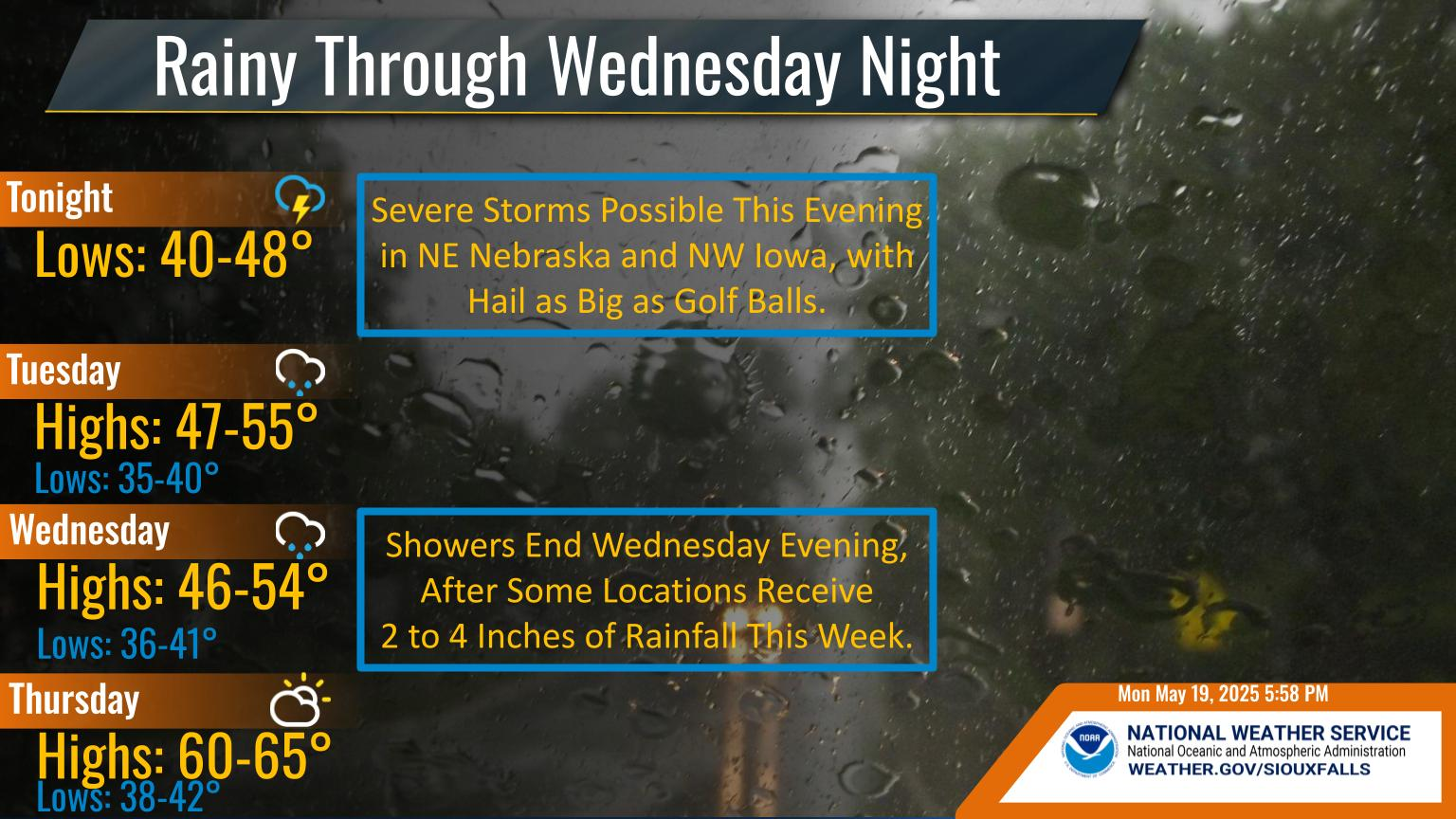
Rain will continue throughout the day, with another inch or two of rain likely for many, especially over southwest Minnesota and nearby counties of South Dakota and Iowa. Please drive slowly and watch out for ponding water on roads.
Some locations have already seen 4 inches of rain in the last 24 hours, with locally higher amounts of up to 7 inches. More rain is on the way today. A slight risk of excessive rainfall continues for the eastern portion of our area. Stay alert for flooded roadways, take precautions while driving. River, creek, and stream rises are also occurring.
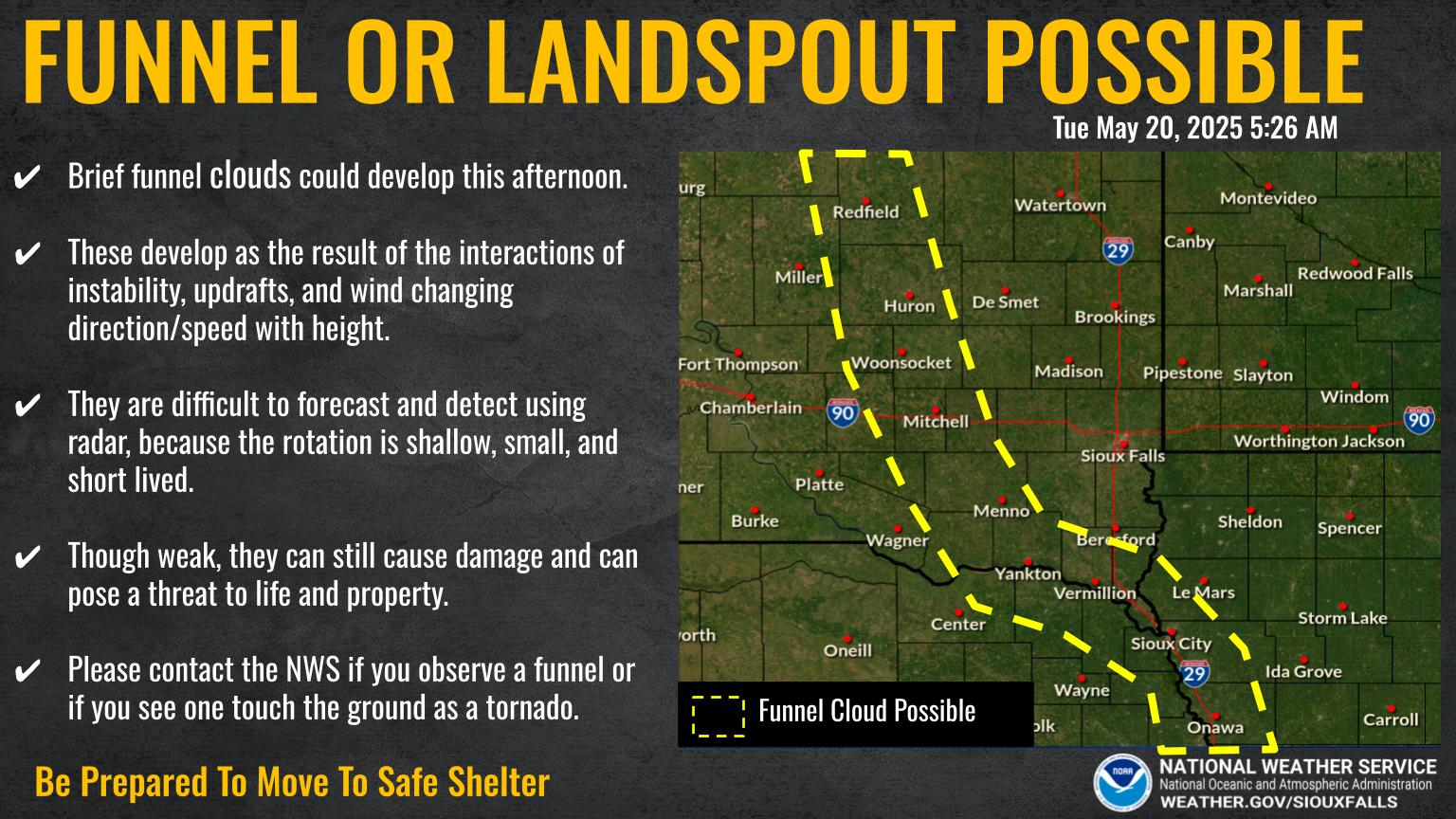
There is a chance of severe weather today, from early afternoon to early evening. The greatest threat for severe weather is in northwest Iowa and southwest Minnesota. All modes of severe weather are in play, with the greatest hazards being damaging winds and large hail. A tornado or two are possible. Stay weather aware and have a way to receive warnings. Have a plan should a warning be issued in your area.
Iowa DOT Road Conditions: CLICK HERE
For Iowa DOT Plow Map: CLICK HERE
Minnesota DOT Road Conditions: CLICK HERE
South Dakota DOT Road Conditions: CLICK HERE
Nebraska DOT Road Conditions: CLICK HERE
North Dakota DOT Road Conditions: CLICK HERE
Missouri DOT Road Conditions: CLICK HERE
Illinois DOT Road Conditions: CLICK HERE