
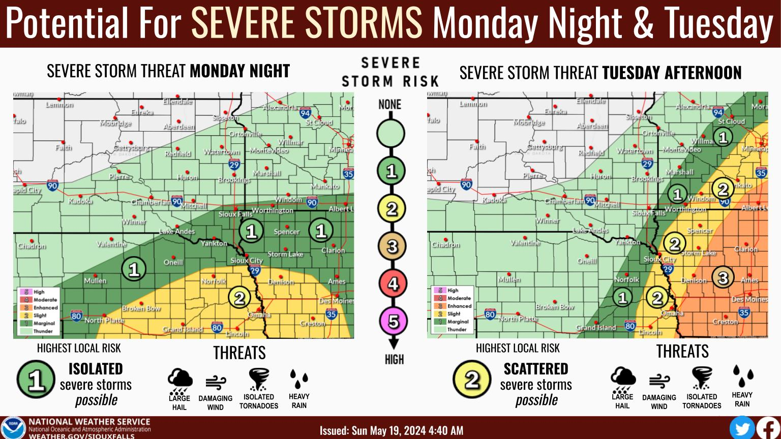
Northwest Iowa — Very windy, very dry and very warm! A very dangerous day if a fire starts. Please do your part to avoid putting others at risk.
* WIND…South to southwest 20 to 30 mph with gusts to 50 mph.
Then winds quickly shift to the northwest this afternoon and
evening as a strong cold front pushes through with gusts 40
to 50 mph.
* HUMIDITY…As low as 15 to 25 percent.
* IMPACTS…Any fires that develop will likely spread rapidly.
Outdoor burning is not recommended.
PRECAUTIONARY/PREPAREDNESS ACTIONS…
A Red Flag Warning means that critical fire weather conditions
are either occurring now….or will shortly. A combination of
strong winds…low relative humidity…and warm temperatures can
contribute to extreme fire behavior.
Winds will increase quickly with gusts of 40 to 50 mph expected this afternoon. Stronger winds will continue overnight then increase again Tuesday with gusts around 40 mph likely.
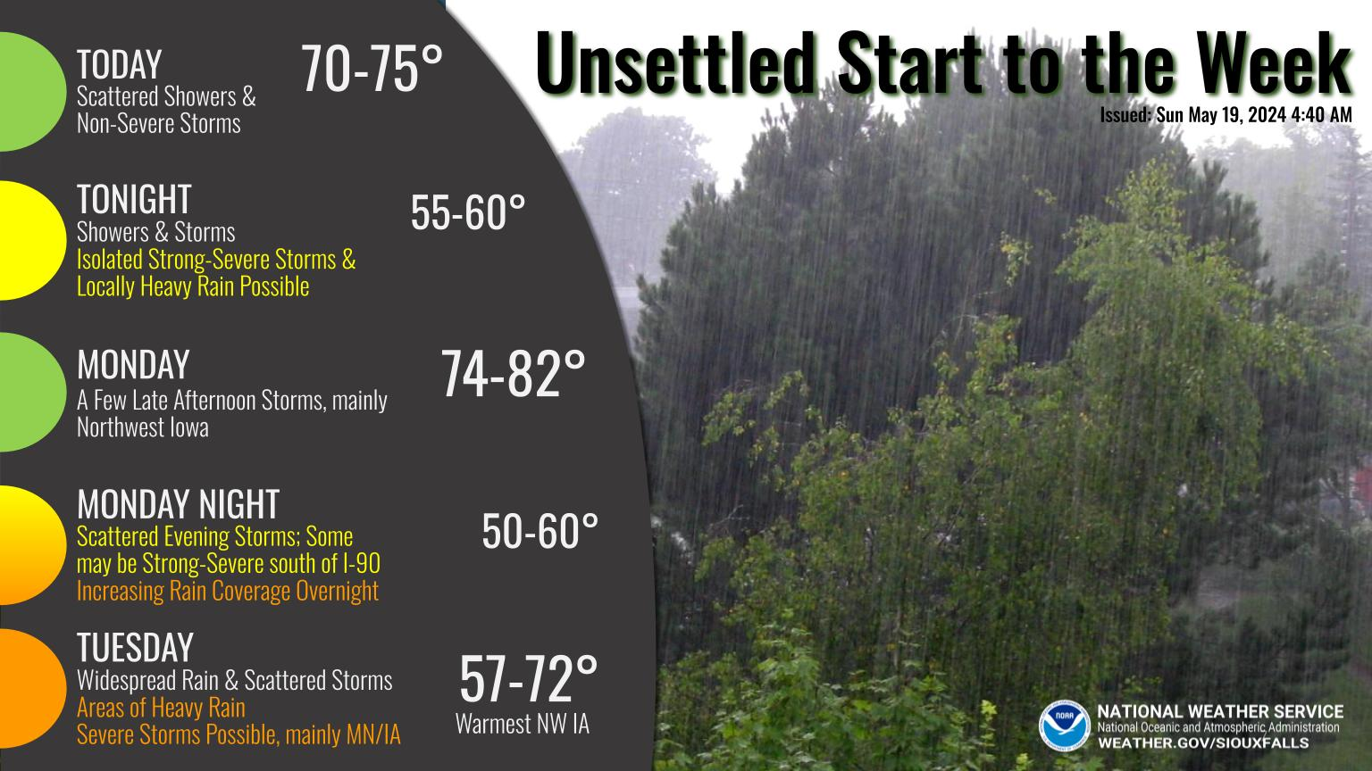
Very warm, very windy and very dry today which means avoid burning! Strong winds will continue tonight into Tuesday with continued dangerous fire weather conditions on Tuesday. Cooler Tuesday through Thursday with temperatures back into the 70s for most locations Friday through Monday.